Our method in battlefield archeology
The sources of battlefield research are military documents, maps and reminiscence of eye-witnesses. First we have to select all information about the location of the battlefield. We show all data on a map, for which we use different maps. (For instance 1:25 000 map for overview and 1:10 000 for field-work.) The air photo often consists valuable information. We have to purchase old maps too. After that we try to reconstruct the original profile of the site.
We look for the remains of battle during the first survey, for instance, trenches, holes. We use metaldetector to look for artifacts. If we have found something, we excavate, record the coordinates with GPS, sign with marker flag and leave on its original place. When we have searched the whole place, the marker flags shows the site of combat. Then we have to check this area systematicaly.
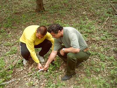
First we have to set out sections with tape-measure and mark with white elastic stripe. Generally we set out 5X5 m, 10X10 m or 10X20 m wide sections. We check the area of section with metaldetector. The place of new artifacts is also signed with marker flags. When we have finished, we record the locations of markers on a sketch. On the sketch, we number all artifacts and collect them in numbered bags.
We take a photo of all artifacts with a 10 cm long gauge. In case of larger objects we use a 0,5 or 1 m long gauge.
During the survey we have to choose and record the coordinates of suitable points to calibrate the map with GPS.
Setting out the section
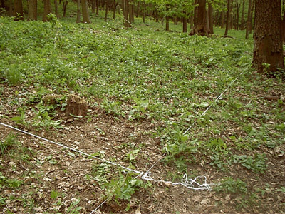
The section.

Search with metaldetector
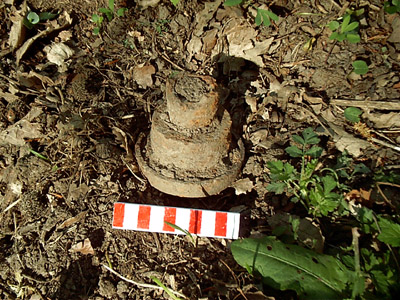
Artifact with a 10 cm long gauge
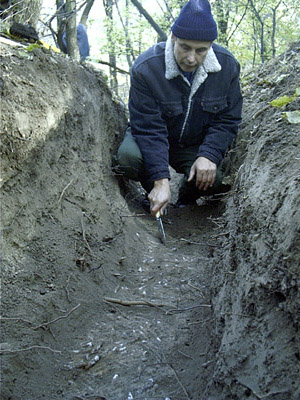 |
Trench excavation. In the bottom of the trench there is a mass of cartridge cases.